The Kamala Valley also called Udayapur Valley. It is situated in the Udayapur district in southeastern Nepal. The Kamala valley or Udayapur valley is drained by the Triyuga river which flows east to merge with Nepal’s Koshi river. The valley lies between the Mahabharata Range to the north and the Sivalik Hills to the south. Moreover, the shape of the valley is rectangular land and it is the land of some endangered animals like wild Asian water buffalo.
The lands and environment at the Udayapur are considered to be wetland which includes some grasslands and small patches of riverine forest as well as it has also a Ramsar Site. In the east of the district separates it from Sunsari District, Sun Kosi river in the north draw a borderline which separates it from Bhojpur and Khotang, Nepal and it is falls in Eastern Development Region in Sagarmatha Zone.
Geographical Structure
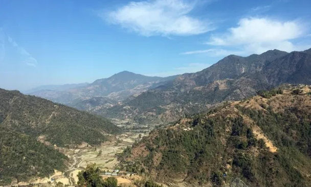
Kamala Valley or Udayapur valley elevations between 360 meters to 2310 meters above sea level which enable it to have a variety of topography, geology, and altitude. As we mentioned above, this valley is surrounded by Mahabharata hills, which stretches from Sun Koshi from the northern side.
Apparently, the 60% area in this region is covered hills. Meanwhile, Udayapur also consists of Churiyahills which enables this region to have a plain and fertile land. However, on the basis of studies, 9% of the land of the district consists of small valleys of inner Terai, Nepal.
The territory is situated primarily at the Triyuga and Tawa River boundaries. The Churiya range lies to the south of this area where inner Tarai occurs. This area is highly impacted by the river cutting or flooding issue.
Places to Visit Around This Region
This region has a bit less coverage due to which it has not been the mainstream tourist attraction. However, there are lots of places around this region which needs a wide range of coverage to promote this place as a hub of tourist. Therefore, some of the potential tourist attractions around this region are given below.
Tribeni: It is a place in Katari municipality where the three rivers Kamla, Tawa and Dudhauli adjoins. It is visited by many devotees on the occasion of Makar (Maghe) Sankranti.
Rauta: Rauta is a holy place for Hindus located in Rautamai rural municipality. It is located on Mahabharat hills at the election of 2,000 feet (610 m) from sea level. There is also a temple of Mahadev as well as a Pond called Rauta Pokhari. Evidently, the pond is in the center of surrounded evergreen tall forest.
Koshi Tappu: Koshi Tappu is a protected area for wildlife. It is located in the south-eastern part of Udayapur near Koshi River. Rampur is the nearest city in Udayapur from Koshi Tappu.
Chaudandigadhi Durbar: The remains of Chaudandigadhi fort of Sen Kingdom[9] can be seen in Chaudandi. The kingdom of Chaudandigadhi was captured by Gorkha Army in 16 July 1773.