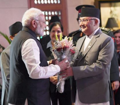
The very old friendship between Nepal and India is on the brink to collapse due to border disputes between these countries. Meanwhile, all of these started seven months ago, on November 2, 2019, when India revealed a new map which includes Kalapani side in their part of the country. However, following year Indian Prime Minister Narendra Modi visited Nepal three times, so the Nepalese government was trying to solve the issue through bilateral talk.
But things started to get worse when Defense minister of India Rajnath Singh announced a new road to help pilgrims visit Kailash-Mansarovar and to increase trade with China through the Lipulekh. Just after the incident, the massive wave of protest against the Indian Government marched down in the road of Kathmandu.
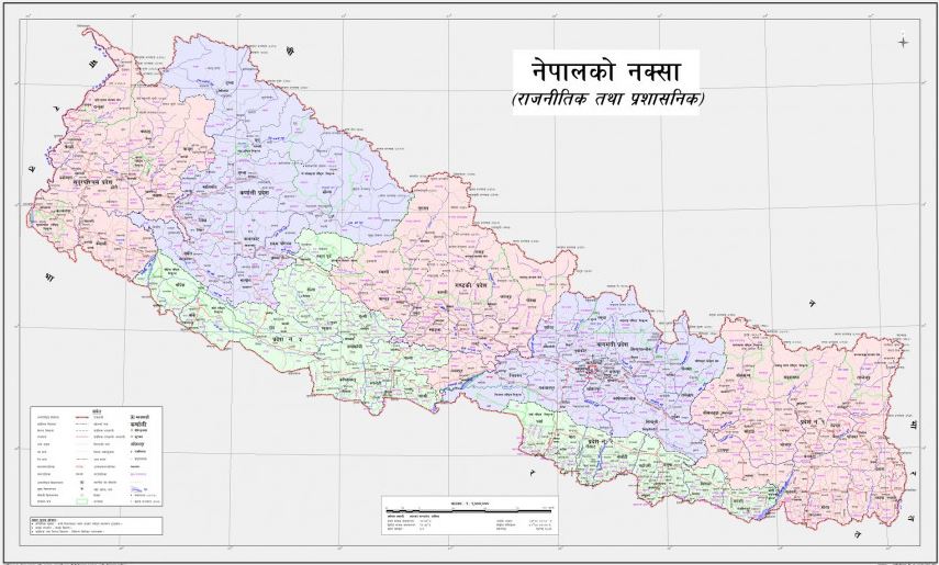
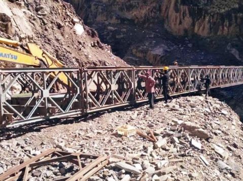
The Lipulekh Pass, a border area of Nepal, India, and China is a far west point near Kalapani. In India’s point of view, Kalapani seems to be the part of Uttarakhand’s district of Pithoragarh, which is part of the district, Dharchula. However, for a long time both India and Nepal claim Kalapani as a significant component of their territory.
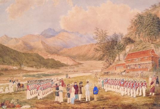
If we dig deep into its roots then, dating back to 1816, to stop the British invasion in Nepalese territory Nepalese Monarch and East India Company made a treaty which is famously known as the Sugauli treaty. According to Article Five of the Sugauli Treaty between Nepal and the East India Company, the Kali River is the western boundary of Nepal with India.
According to a map drawn by the East India Company ten years after the Treaty, the river with the Limpiadhura estuary is the Kali River and the Kali river suppose to separate the border between Nepal and India. Which means both countries currently have their own opinion about the Kali river. But according to acient history and Sugauli treaty, Kalapani, Lipulekh falls under the Nepalese territory.
Moreover, the current issues between these countries clearly show the contradiction on the 200 years old agreement. The new map of India shows the encroachment of 372 square km area on the western border of Nepal. For instance, since the Sino-Indian War with China in 1962, the currently disputed land has been controlled by India’s Indo-Tibetan Border Police.
In addition, after the opening of the road, by India, Nepal Government released a new political map on May 21, which includes areas like Kalapani, Lipulekh, and Limpiyadhura within its borders. Nepalese Communist party member, House of Representative, and the current, Minister of Land Management Cooperative & Poverty Alleviation, Padma Kumari Aryal, request the new political map of Nepal which was approved by the Nepalese Prime Minister Khadga Prasad Sharma Oli (K.P Oli).
Based on the new political map of Nepal, the total area of Nepal has been increased. The entire area has enlarged from 147, 181 square kilometers to 147, 516 square kilometers. The new political map of Nepal has added 335 square kilometers, and it covers the territory like Gunji, Navi, and Kuti Kalapani and Lipulekh.
If we look closely, then we can see that the Government of Nepal has opposed India’s invasion on Nepal territory for a long time. In 2015, in the Joint Statement of May 5, 2015, issued during India’s Prime Minister Narendra Modi’s visit to China, Nepal expressed its disagreement by issuing separate diplomatic notes to governments in China and India, when both sides agreed to include Lipulekh pass as a bilateral trade route without Nepal’s consent.
Source: https://bit.ly/2XdAWKK
Furthermore, the relationship between Nepal and India is bit worse now. However, Nepalese Foreign Minister Pradeep Kumar Gyawali said that;
“Nepal has special and good ties with India and the Kalapani issue between neighborhoods will be resolved via bilateral talks.”
So far, Indian government has not responded officially. But most of the Indian political leaders and media is claiming that the surprising steps of Nepal are done under the influence of China.
According to Indian Army chief Gen MM Naravane, the Nepalese political system is under the considerable influence of China. And he also said that China is the one who is trying to ruin the ancient relationship between Nepal and India. But in recent National Assembly Prime Minister K.P, Oli considered, all the statement and interpretation of Indian Officials and Indian media as humiliation for Nepal and he clearly denied any invasion of a foreign power in the Nepalese political system.
For now, there is no any G2G meeting between India and Nepal has been announced. Due to the Covid-19 pandemic, these two countries has unable to address each other opinions on border disputes. Therefore, it will take a bit of time to resolve the rising issues and problems between these countries.